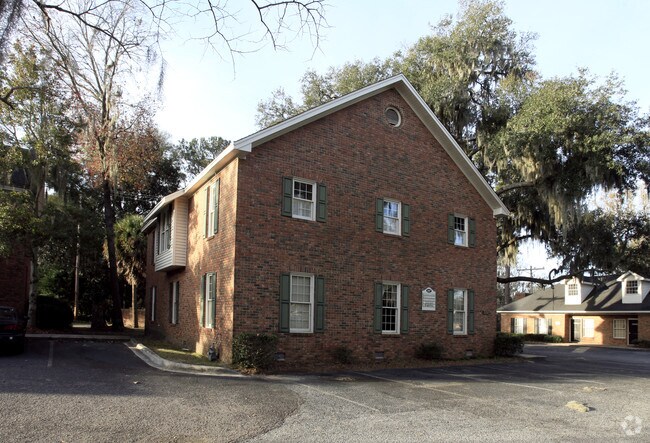
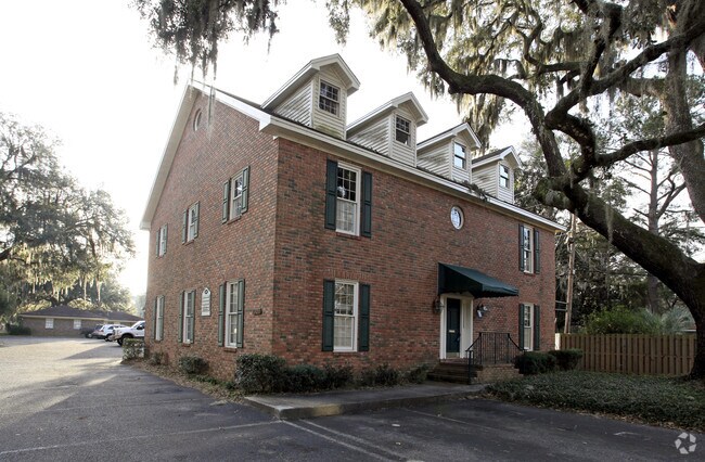
Property Record
327 Eisenhower Dr, Savannah, GA 31406
NEARBY LISTINGS FOR SALE OR LEASE
Property Detail
327 Eisenhower Dr
Savannah, GA
Cambridge Row
2049105020
LT B-1 CAMBRIDGE ROW
Officebuilding
Chatham
X
Georgia
45053C0550D
b-1
2024
0.08 AC
2025
Greater Savannah
004002
Savannah
3,888 SF
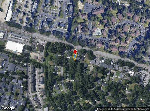
DEMOGRAPHICS near 327 Eisenhower Dr
1 Mile
3 Mile
5 Mile
2024 Total Population
5,291
62,223
143,890
2029 Population
5,412
64,222
149,478
Pop Growth 2024-2029
+ 2.29%
+ 3.21%
+ 3.88%
Average Age
41
39
39
2024 Total Households
2,383
24,938
59,456
HH Growth 2024-2029
+ 2.18%
+ 3.29%
+ 4.15%
Median Household Inc
$54,435
$55,274
$53,296
Avg Household Size
2.00
2.30
2.20
2024 Avg HH Vehicles
2.00
2.00
2.00
Median Home Value
$228,846
$199,987
$209,393
Median Year Built
1974
1971
1968
Nearby Places
Map Layers
Map Styles
 Street
 Aerial
- Restaurants
- Banks
- Shops
- Fitness
- Groceries
PUBLIC TRANSPORTATION
COMMUTER RAIL
DRIVE
WALK
Distance
15 min
8.4 mi
AIRPORT
Savannah/Hilton Head International
DRIVE
WALK
Distance
Savannah/Hilton Head International
27 min
15.2 mi
Hilton Head
DRIVE
WALK
Distance
Hilton Head
69 min
42.4 mi
SALE & LEASE HISTORY
LISTING DATE
SALE/LEASE

Feb 21, 2017
For Sale
Nearby Properties
Address
Land Use
TOTAL SIZE
Lot Size
Zoning
Address
Land Use
TOTAL SIZE
Lot Size
Zoning
14,252 SF
52.91 AC
RIP
Address
Land Use
TOTAL SIZE
Lot Size
Zoning
0.12 AC
R6
Address
Land Use
TOTAL SIZE
Lot Size
Zoning
559,705 SF
44.25 AC
BC
Address
Land Use
TOTAL SIZE
Lot Size
Zoning
6,245 SF
13.52 AC
PUDISB
Address
Land Use
TOTAL SIZE
Lot Size
Zoning
52,272 SF
82.59 AC
RIP
Address
Land Use
TOTAL SIZE
Lot Size
Zoning
100 SF
15.62 AC
RM25
Address
Land Use
TOTAL SIZE
Lot Size
Zoning
18,138 SF
12.80 AC
RM25
Address
Land Use
TOTAL SIZE
Lot Size
Zoning
16,896 SF
11.32 AC
IP
Address
Land Use
TOTAL SIZE
Lot Size
Zoning
8,480 SF
16.50 AC
PUDM25
Address
Land Use
TOTAL SIZE
Lot Size
Zoning
7,344 SF
13.09 AC
RM25
Address
Land Use
TOTAL SIZE
Lot Size
Zoning
14,249 SF
14.92 AC
BC
Address
Land Use
TOTAL SIZE
Lot Size
Zoning
8,064 SF
14.70 AC
RM25
Address
Land Use
TOTAL SIZE
Lot Size
Zoning
59.65 AC
RIP
Address
Land Use
TOTAL SIZE
Lot Size
Zoning
128,061 SF
29.78 AC
R6
Address
Land Use
TOTAL SIZE
Lot Size
Zoning
85,606 SF
16.30 AC
BC
Address
Land Use
TOTAL SIZE
Lot Size
Zoning
2,226 SF
67.62 AC
IP
Address
Land Use
TOTAL SIZE
Lot Size
Zoning
4,832 SF
6.43 AC
I-L
Address
Land Use
TOTAL SIZE
Lot Size
Zoning
34,945 SF
18.22 AC
I-P
Address
Land Use
TOTAL SIZE
Lot Size
Zoning
297,627 SF
28.63 AC
PUDIS
Address
Land Use
TOTAL SIZE
Lot Size
Zoning
302,600 SF
7.49 AC
R6
Address
Land Use
TOTAL SIZE
Lot Size
Zoning
15,792 SF
10.50 AC
I-P
Address
Land Use
TOTAL SIZE
Lot Size
Zoning
5,452 SF
5.81 AC
RM25
Address
Land Use
TOTAL SIZE
Lot Size
Zoning
17.78 AC
R1
Address
Land Use
TOTAL SIZE
Lot Size
Zoning
7,500 SF
0.92 AC
RIP
Address
Land Use
TOTAL SIZE
Lot Size
Zoning
79,092 SF
1.18 AC
BC
Address
Land Use
TOTAL SIZE
Lot Size
Zoning
99,599 SF
13.50 AC
R1
Address
Land Use
TOTAL SIZE
Lot Size
Zoning
6,812 SF
9.48 AC
RM25
Address
Land Use
TOTAL SIZE
Lot Size
Zoning
6,296 SF
15.09 AC
PUDM15
Address
Land Use
TOTAL SIZE
Lot Size
Zoning
7,256 SF
8.73 AC
RM25
Address
Land Use
TOTAL SIZE
Lot Size
Zoning
101,262 SF
1.79 AC
BC
The World's #1 Commercial Real Estate Marketplace
Connect with us
© 2025 CoStar Group
The information above has been obtained from sources believed reliable. While we do not doubt its accuracy we have not verified it and make no guarantee, warranty or representation about it. It is your responsibility to independently confirm its accuracy and completeness. Any projections, opinions, assumptions, or estimates used are for example only and do not represent the current or future performance of the property. The value of this transaction to you depends on tax and other factors which should be evaluated by your tax, financial, and legal advisors. You and your advisors should conduct a careful, independent investigation of the property to determine to your satisfaction the suitability of the property for your needs.